|
Camp Muir Difficulty: omg yikes wtf 8.5 miles Elevation gain: 4700' Max elevation: 10100' Camps: Camp Muir First hiked by me: older |
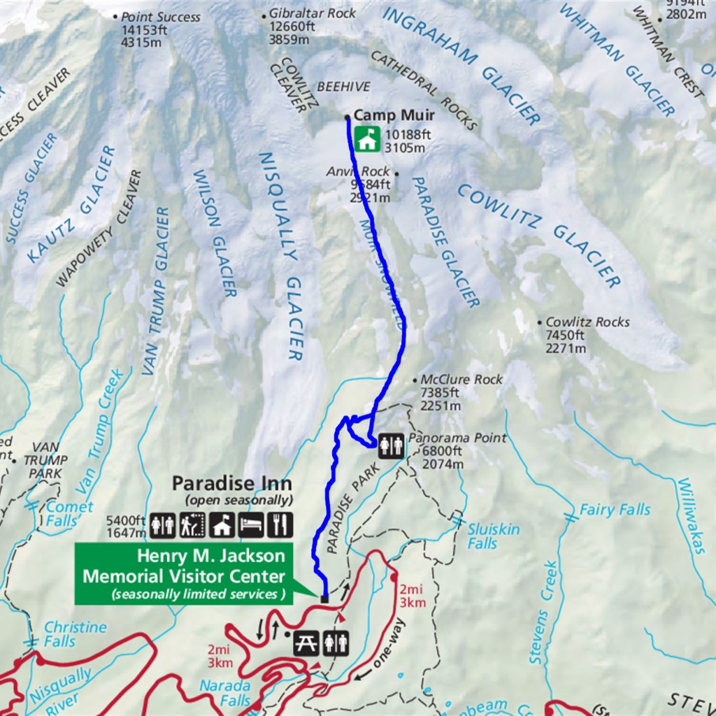
I had been intrigued and intimidated by Camp Muir ever since first falling in love with Mount Rainier, hiking Panorama Point and Skyline Trail, and wondering where that path heading on upward signposted Pebble Creek went. My Day Hike Mount Rainier book says:
"It's actually an alpine ascent that shouldn't be attempted by people without proper training and gear. We include it here to warn serious hikers to go prepared, and, frankly, to dissuade the inexperienced and ill-equipped from going at all."
So for years I did not go at all.
Then in 2017 I decided to hike to Muir as a challenge and celebration of having got into better shape. It was incredible. Physically intense and spiritually exhilarating. Pictures don't do it justice.
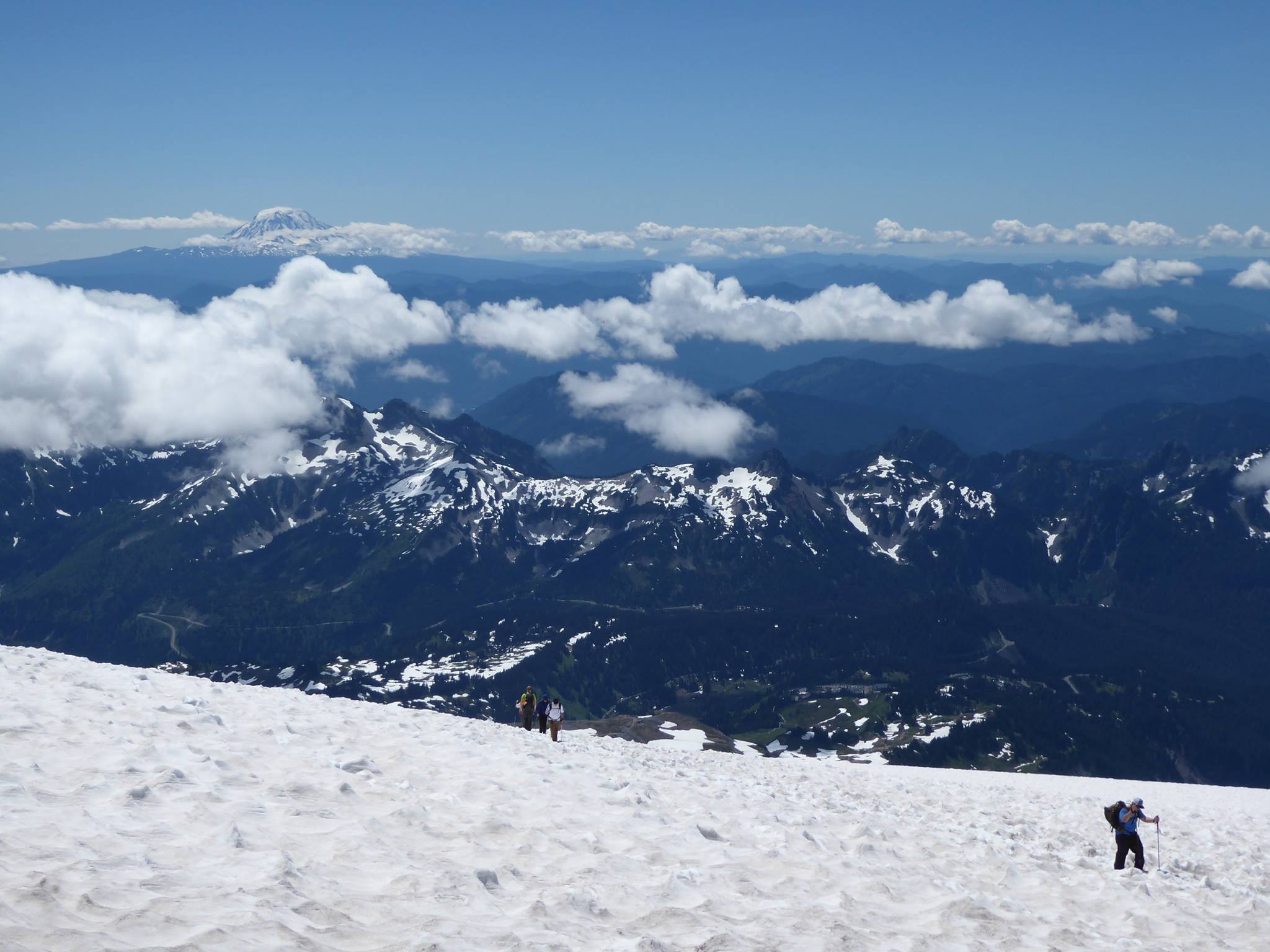
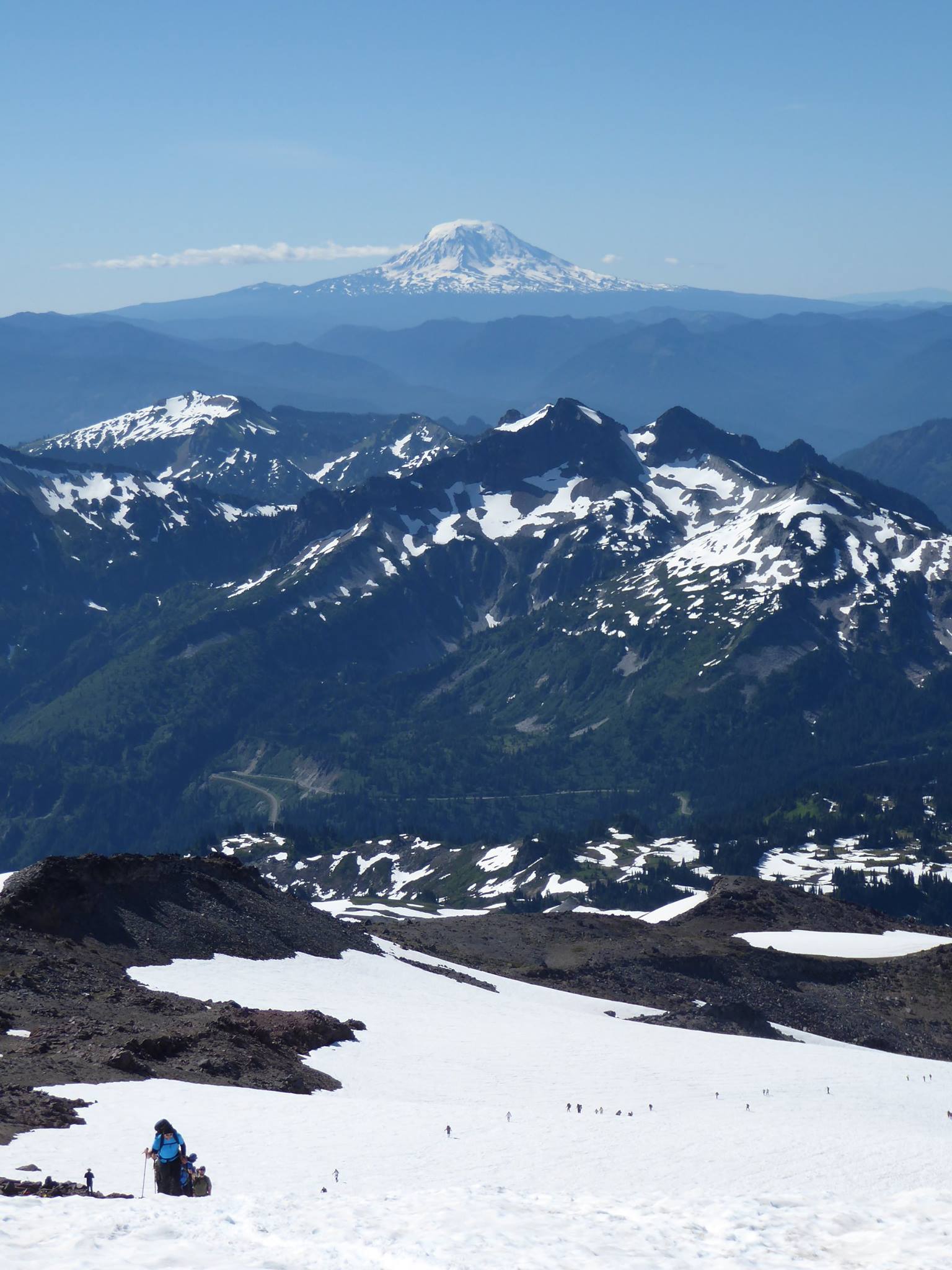
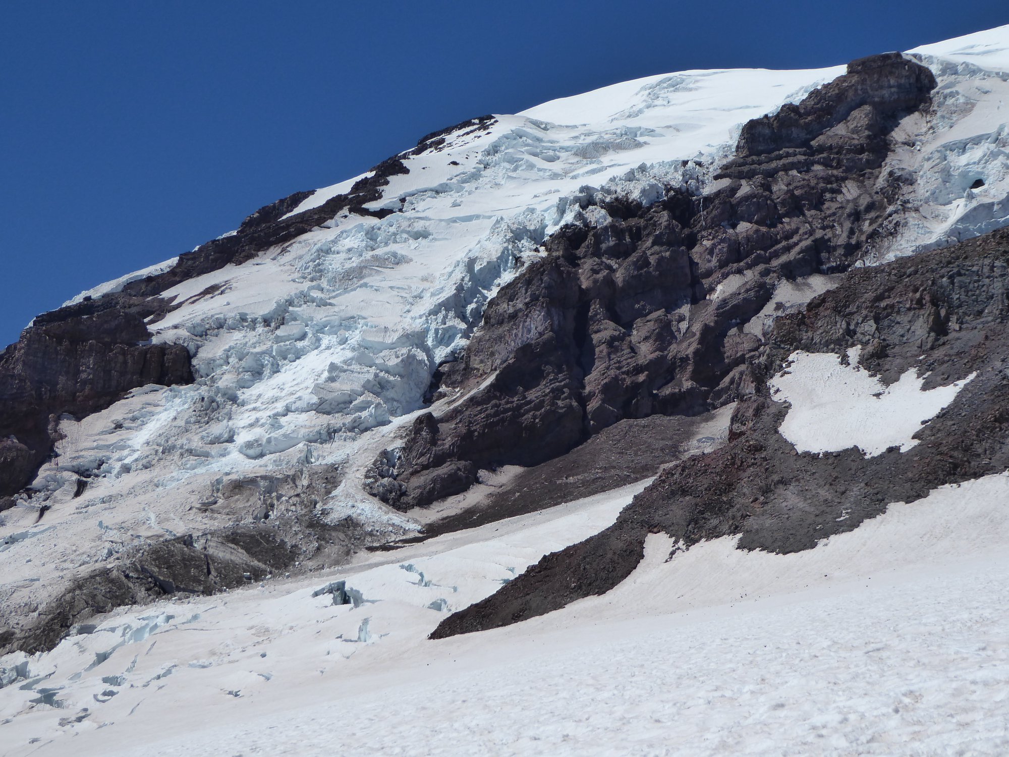
This route is the dividing line between hiking and climbing. It's the highest you can get on Rainier without a climbing permit and glacier travel skills. You will be above the clouds, breathing thin air, looking down on the heavily crevassed glaciers which surround this thin spit of I-can-get-here-with-nothing-but-hiking-boots terrain.
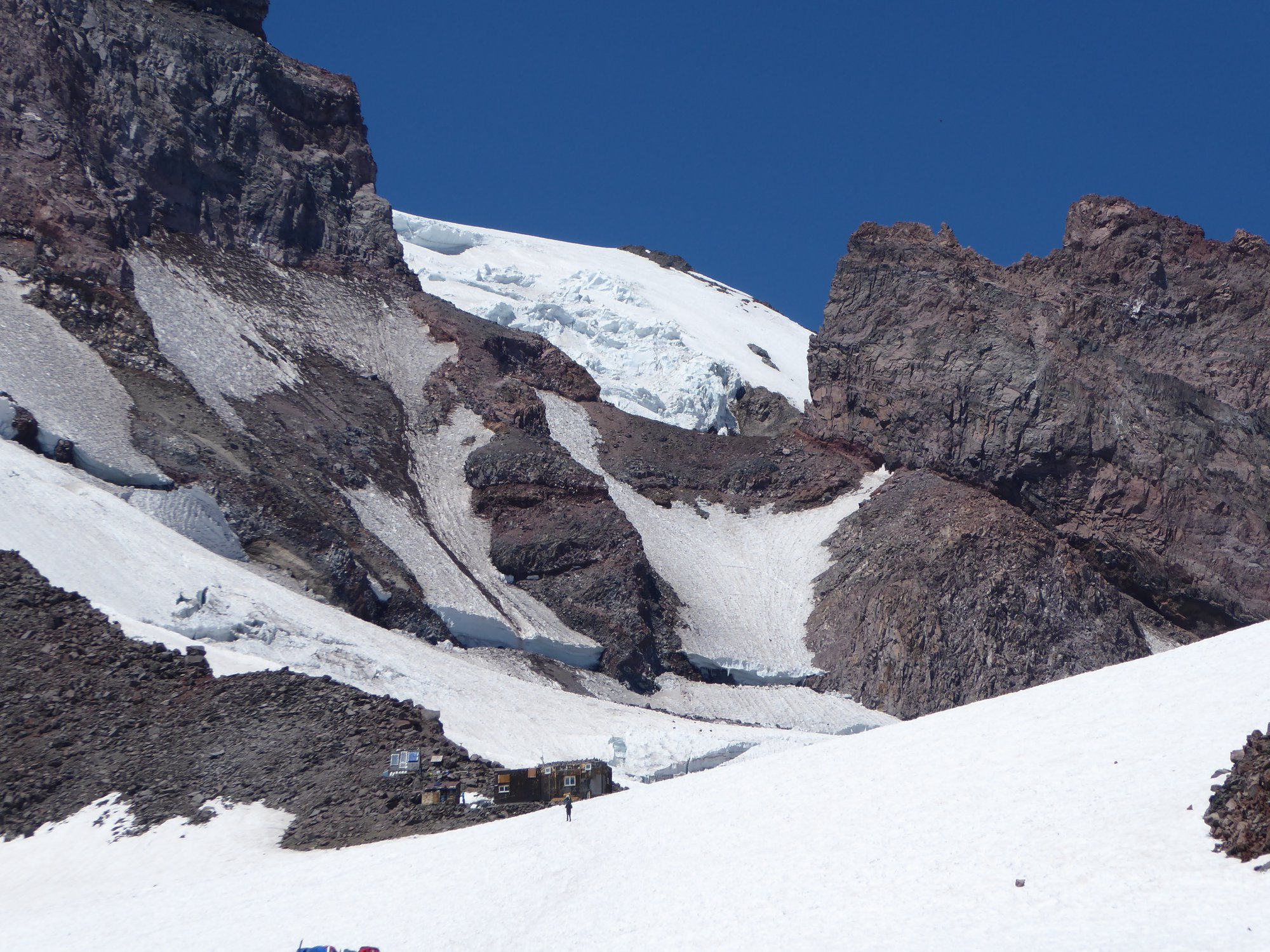
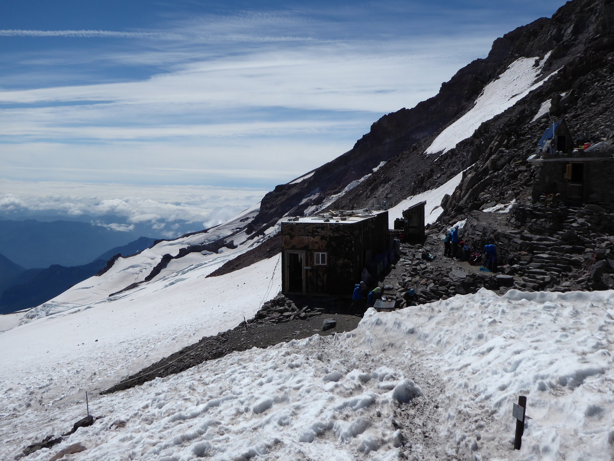
Start at Paradise. Hike up Panorama Point and Skyline Trail, turning left on the trail signposted Pebble Creek if you want to minimize distance, but I recommend continuing to Panorama Point for a nice refuel spot. Onward and upward past Pebble Creek (last chance to refill water bottles) and onto a year-round permanent snowfield. Then up, and up, and up some more, until you eventually reach a high camp consisting of a couple of stone buildings and many tents pitched by climbers who stay here the night before their Rainier summit attempts.
This hike is uniquely hard and dangerous for several reasons:
First off, it's a lot of elevation gain, and you'll be on snow most of the way. Depending on conditions you might want snowshoes (if the snow is soft) or spikes (if the snow is hard and icy). I carried spikes but not snowshoes both times I've hiked to Muir.
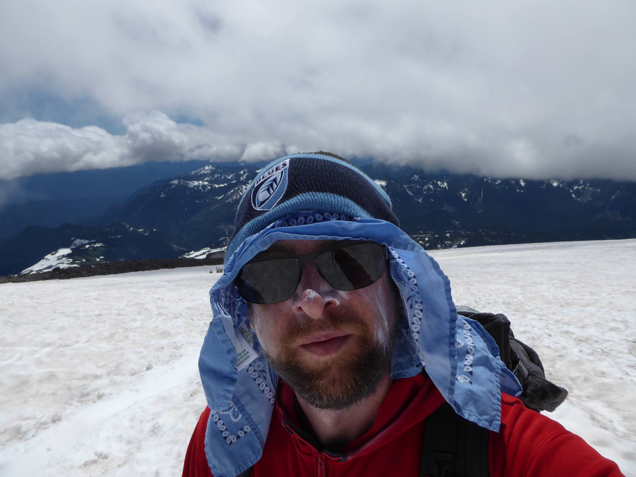
Second, the altitude. Ten thousand feet is categorically different to the 6-7 thousand of other high Rainier trails. If you came from sea level, you will tire faster and move slower than you are used to. You will dehydrate much sooner than normal, which is a bad thing because dehydration increases the risk of altitude sickness (I carried 3 liters of water, which was barely enough). High altitude sunlight reflected off snow will burn your skin even as the wind chills you to the bone (in spite of frequent lotion applications and careful clothing choices, I ended up with sunburn on the inside of my nostrils).
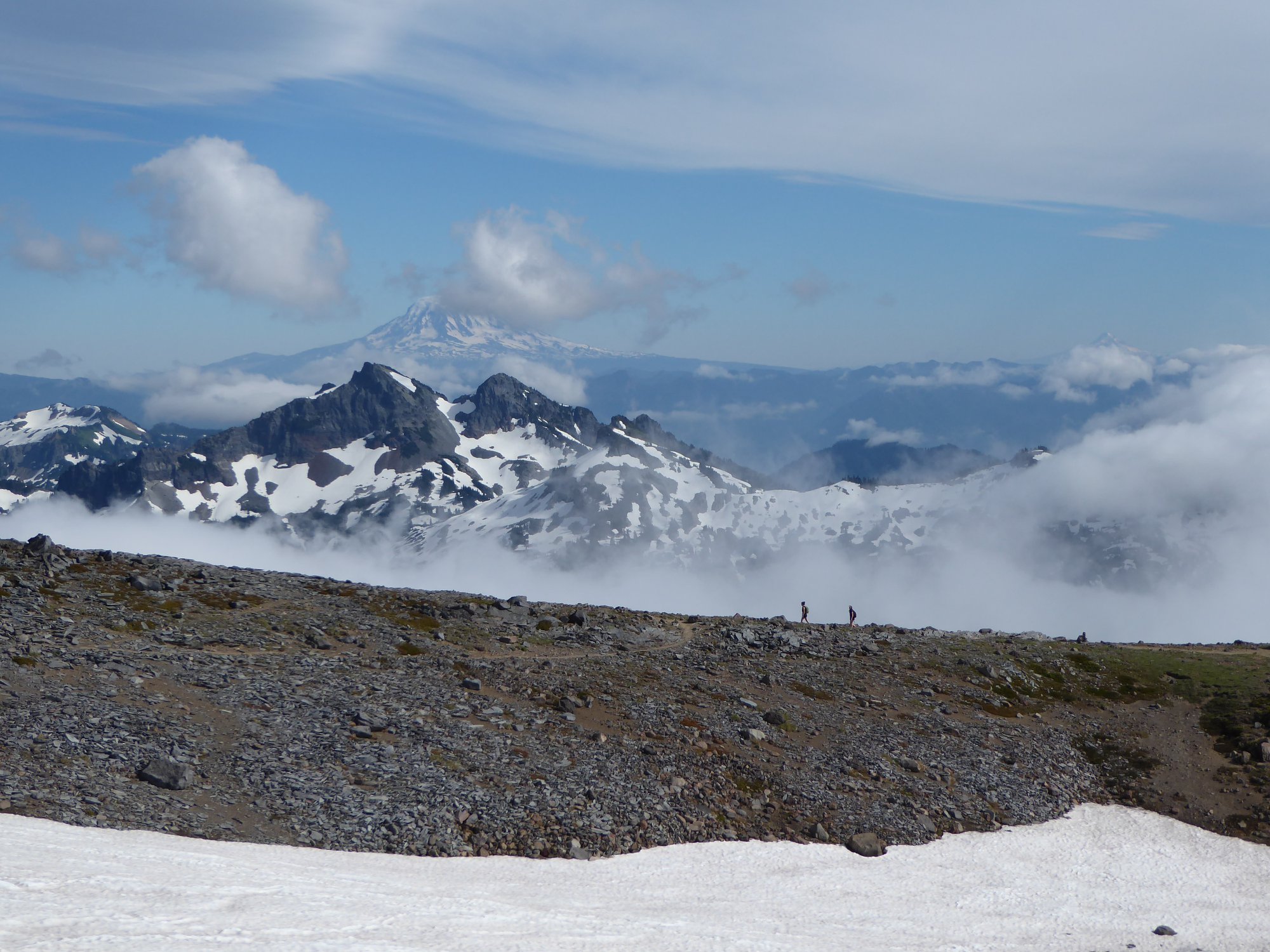
These factors are just nuisances, though, compared to the weather. You know those days when you look at Rainier from Seattle, and the summit is clear, and the lower slopes are clear, but there's a pretty bit of cloud hanging off the mountain part way up? When you hike to Muir, you'll be INSIDE that cloud. This can happen any time, any day, any season. It happened to me near the end of my second Muir hike, thankfully after we were down off the main snowfield, but it was still crazy spooky. Even crossing a small patch of snow, all we could see was white in every direction: white ground, white air - now wait, which way were we going again?
The problem if this happens while on the Muir snowfield is the surrounding terrain. To the east, there are cliffs. To the west, the Nisqually Glacier, which is riddled with potentially life-ending crevasses. The latter is particularly dangerous because the natural fall line of the snowfield leads straight onto the glacier, so it takes conscious effort and good visibility to stay on the route back down to Paradise.
To hike here safely, I recommend a combination of waiting for good weather, multiple navigation techniques (map, compass, GPS, and the skill to use them: this is not the place to for instance ignore the difference between magnetic and true north!) plus enough food and shelter that if you get confused you can just hunker down and wait for conditions to improve.
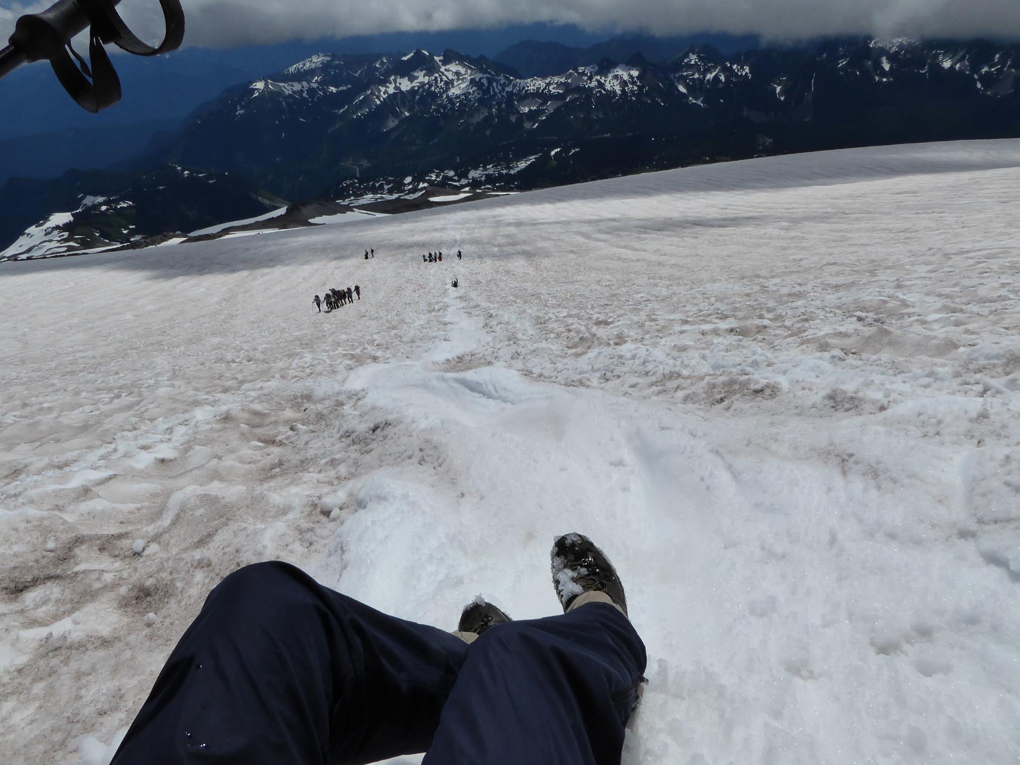
Dangers aside, once you're onto the snowfield this route is pretty much just an uphill slog. At least during good weather, there is no solitude to be had. At times it felt like a conveyer belt of people heading up the snow, but this was a good thing because it would have been spooky/scary if I was on my own. Of course you will pass people who are hiking to Muir wearing tennis shoes, t-shirt and shorts, carrying nothing but a water bottle. That's fine, up until the moment when it isn't. Don't be like them.
On the way back down, you have a choice between glissading (aka sliding on your butt) and plunge stepping. Skilled climbers will be horrified at the idea of glissading without an ice ax (how would you self-arrest in an emergency?) but hey. Both times I hiked to Muir, the snow was soft enough that the problem was how to keep sliding rather than how to stop. I was only able to glissade down the steeper sections, using my waterproof leggings for maximum slipperiness. Others had brought trash bags or even full sleds to ride down on. It's important to check out the entire glissade run before starting down, though. One near the bottom ended in a sinkhole that would have hurt if someone had fallen into it at speed.
When I wasn't sliding down, I learned how to plunge step. That's when you kinda half run down the mountain, letting gravity take care of digging your forward foot into the snow. In the right conditions you can go quite fast with minimal exertion. Much fun, but only recommended on soft snow with no rocks.
The National Park Service provides a PDF with information and compass bearings for the Camp Muir route.