|
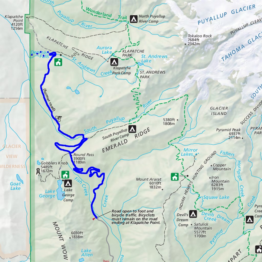
Denman Falls Difficulty: moderate (but long) 15.4 miles Elevation gain: 2130' Max elevation: 3880' Camps: none First hiked by me: 2020 |
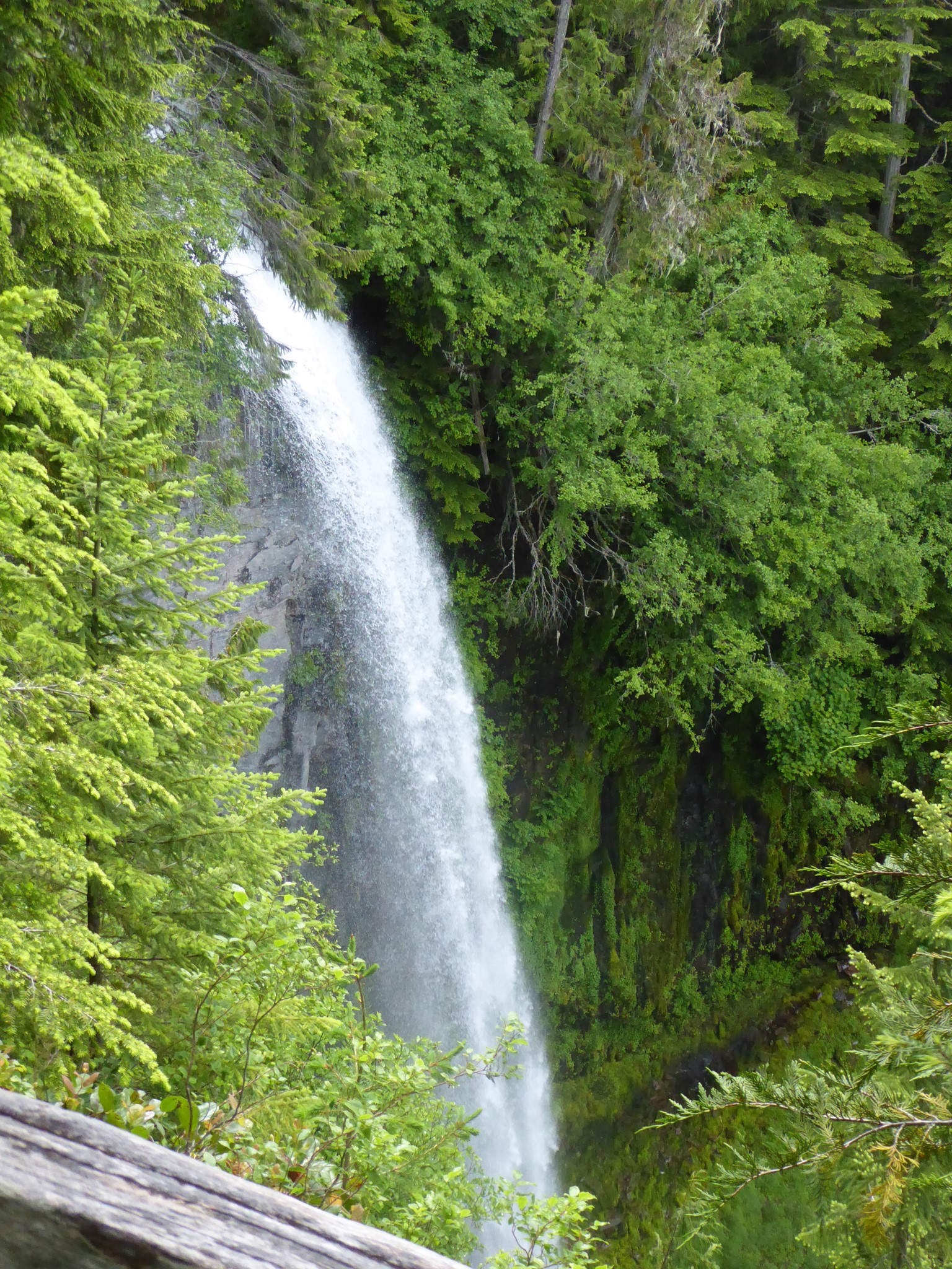
15 miles is an awfully long way to go for any waterfall, especially one like this where much of the distance is fairly boring closed-to-cars road, not to mention the viewpoint of the falls is partially obstructed. Visiting here is more practical if you bike up the Westside Road or already happen to be passing by on your way to Klapatche Park or Westside Road to North Puyallup.
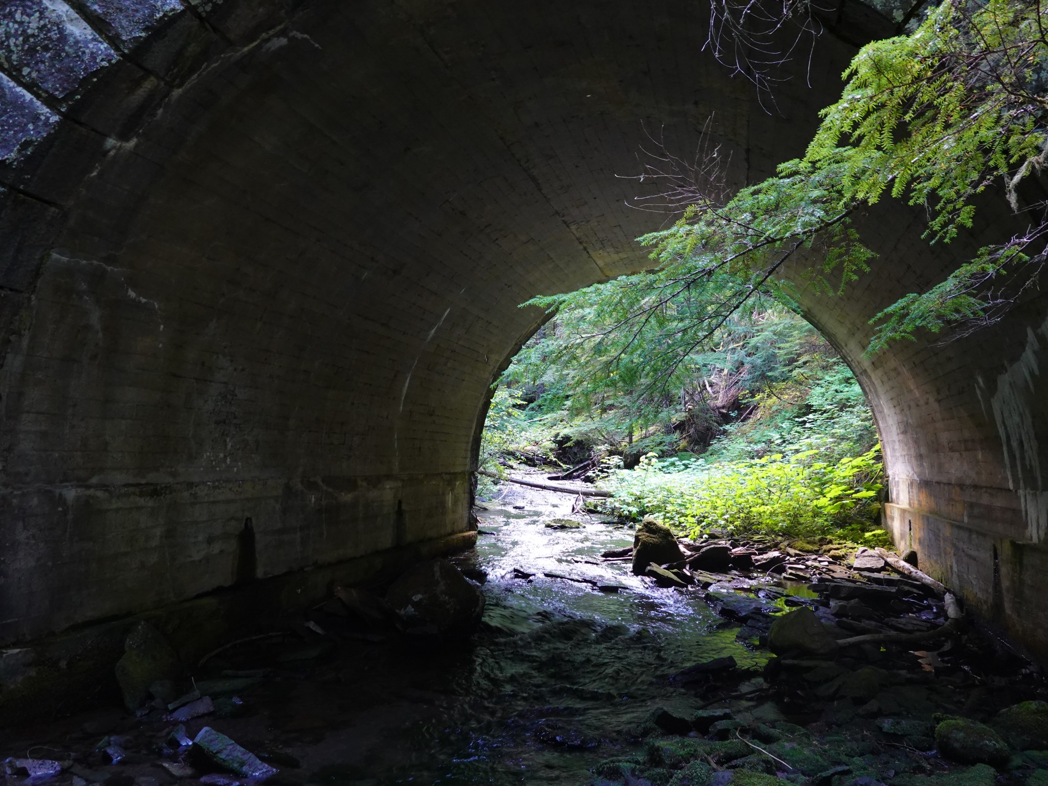
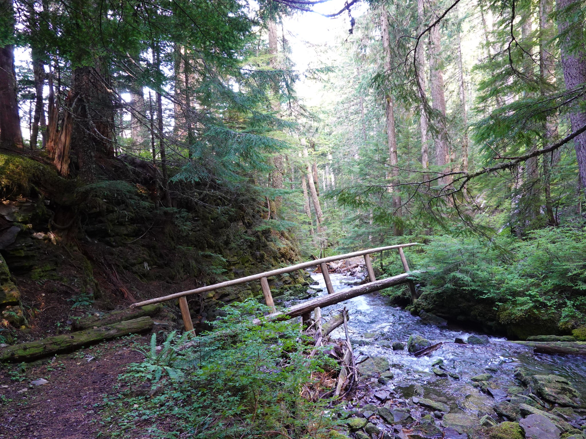
Denman Falls is reached along a pleasant 1/4 mile forested loop trail, the two ends of which start from the Westside Road either side of where it crosses St. Andrews Creek. This is presumably a remnant from when the road used to be open to cars, at which time Denman Falls was an easily accessible family destination, because simply viewing the falls did not require bothering to build this trail as a loop.
Just past Denman Falls you will find a sign stating "End Of Maintained Trail. Travel Safely. Leave No Trace". Signs like this usually mark where official trails transition to climber's paths (e.g. at Glacier Basin and Mirror Lake) or to unmaintained but tolerated-by-the-park routes (Moraine Trail, Van Trump Park). So I wondered, why is such a sign located here?
Research suggested that this trail might head downhill to Larrupin Falls and Ethania Falls, and could even have been the original route of the Wonderland Trail. A 1919 park brochure includes a map that shows the Wonderland descending to the South Puyallup river valley at this location.
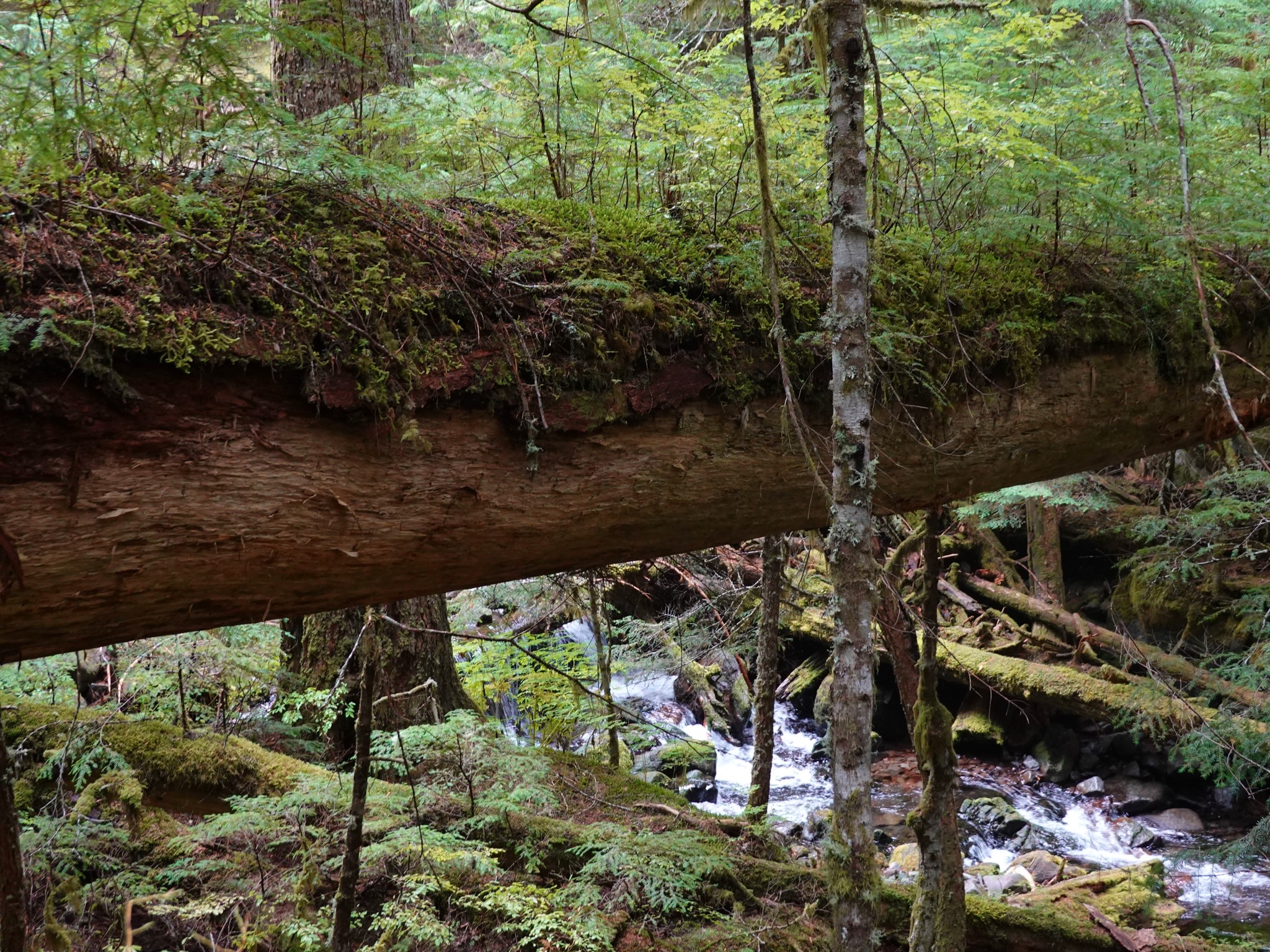
I explored the abandoned trail to Larrupin and Ethania Falls in 2023, and have to say, you should not bother coming here if you're chasing waterfalls. They are treed-in, and I did not find good enough viewpoints to get any photos worth sharing. Parts of the old trail still exist, but it is overgrown with trees in many places and covered with blowdowns in others. Navigationally challenging and not easy going. This is shown as the dotted line on the map above, and not included in the distance or elevation gain.
Having visited this old trail, I now strongly suspect that it was indeed the original route of the Wonderland. It was clearly abandoned a long time ago (fallen trees covering the path are in some cases so rotted that they disintegrate into sawdust the moment your foot touches them) yet the trail was once wide and it switchbacks down the hillside with a gentle gradient. I've hiked enough unofficial routes to know that climber's and fisherman's paths are much more direct about their ascents than this one. An old trail would only have been constructed with this kind of switchback is if it was intended for pack animals such as the horses that early Wonderland circuits depended on.