|
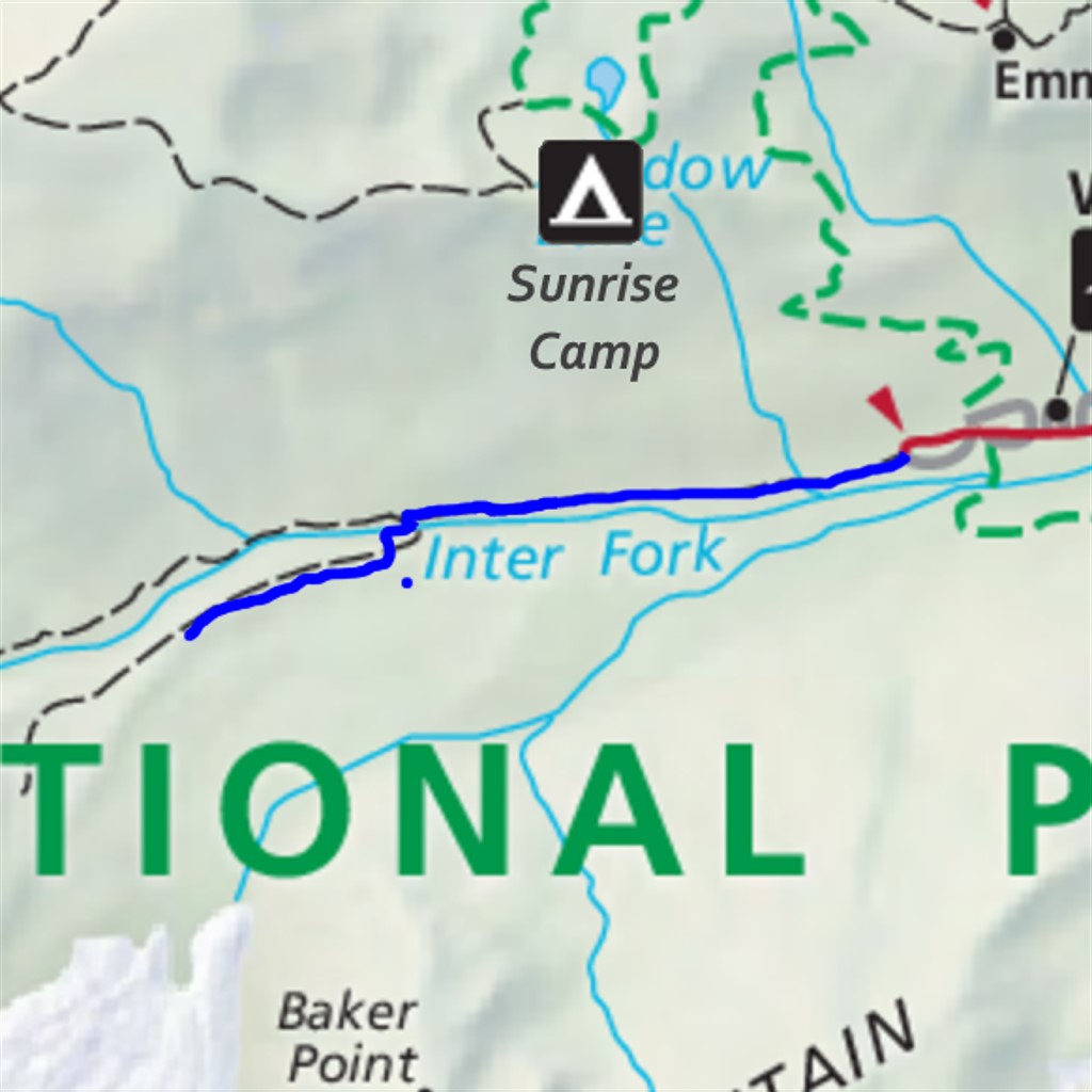
Emmons Moraine Difficulty: easy 3.4 miles Elevation gain: 750' Max elevation: 5020' Camps: White River First hiked by me: older |
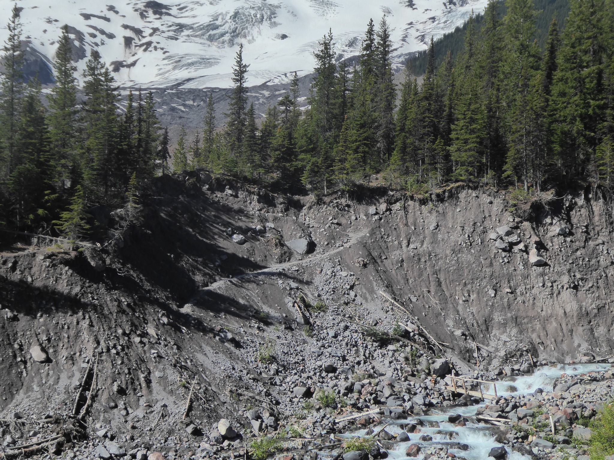
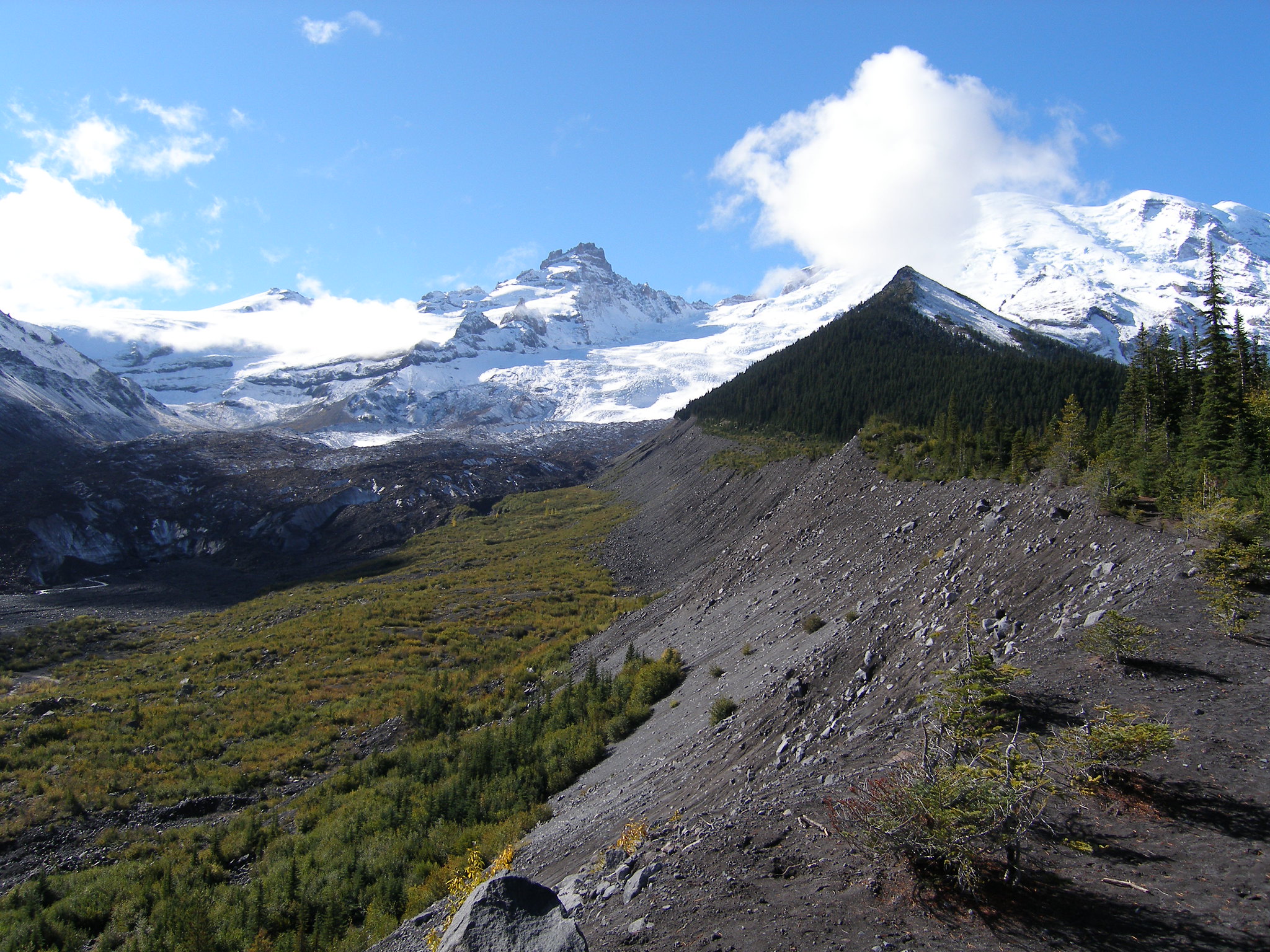
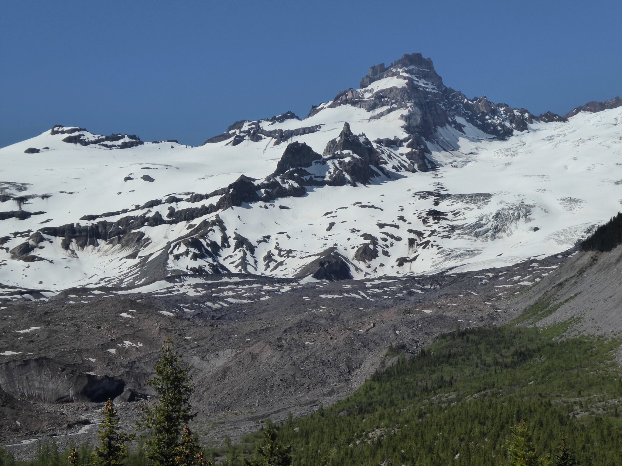
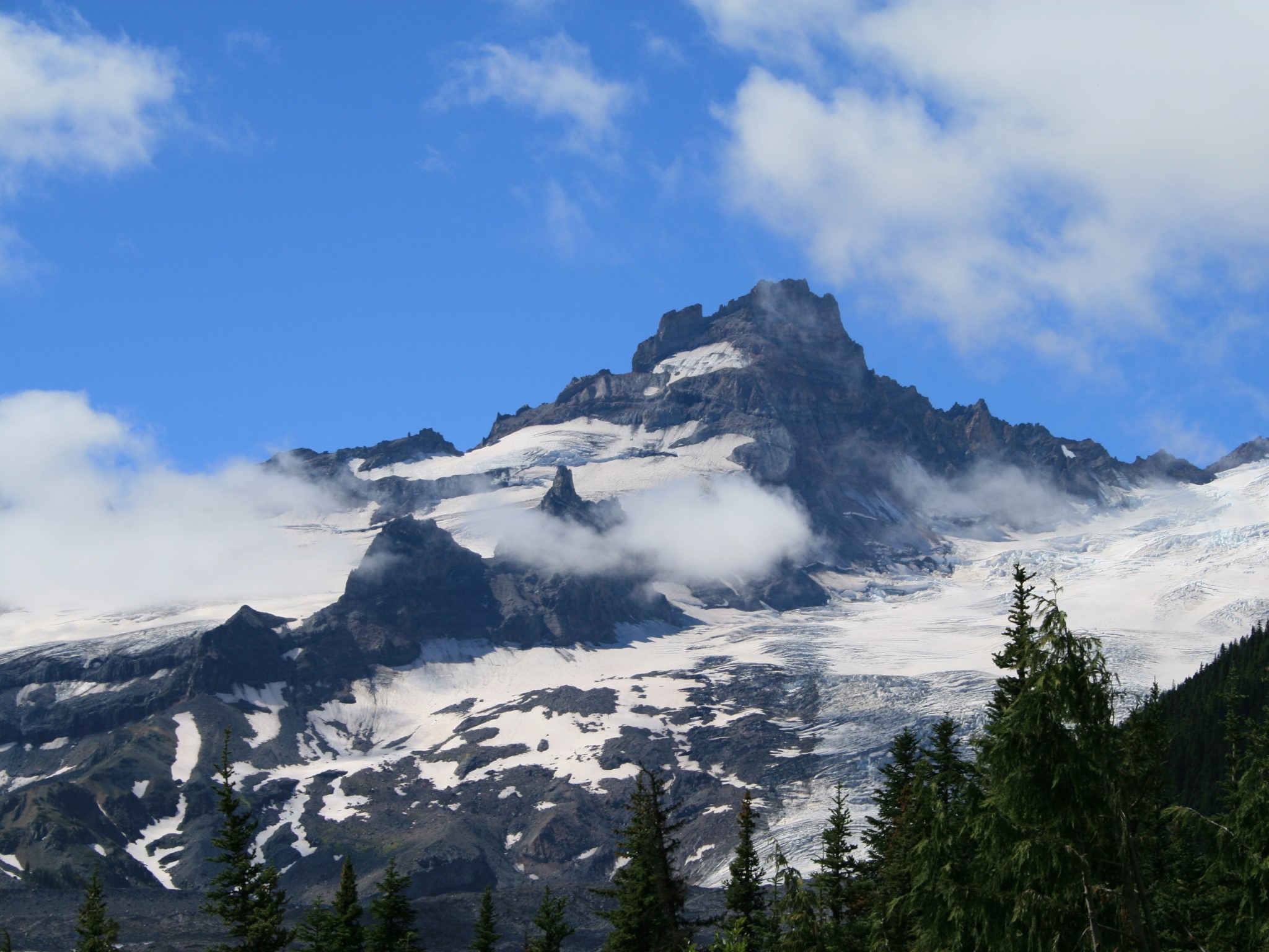
Emmons Glacier is a monster (largest surface area of any glacier in the contiguous United States!) and this trail is the perfect way to see it. Start up the Glacier Basin trail, but a mile past the trailhead turn left onto the side spur signposted for Emmons Moraine. Cross the Inter Fork of the White River, then climb briefly but steeply up the side of an old lateral moraine to a view overlooking the snout of the glacier.
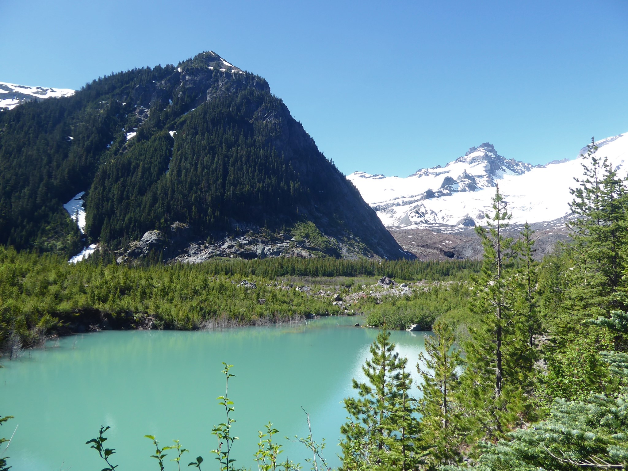
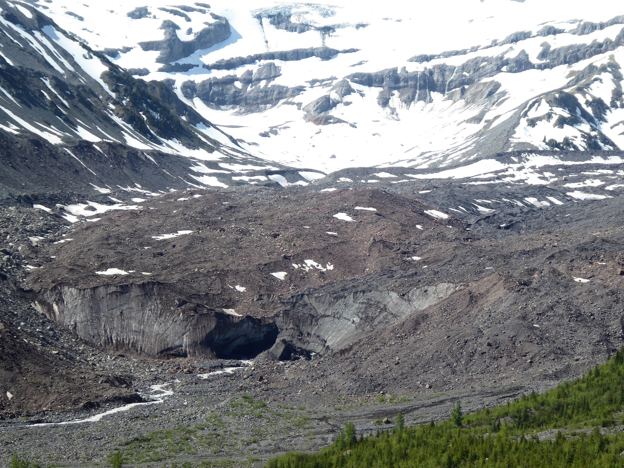
You'll also overlook a lake filled by Emmons meltwater, which is colored turquoise by suspended glacial silt. I find it amazing to think how this water was only recently liberated from hundreds of years of deep freeze within a glacier, during which time it was slowly grinding rock down to ever finer grades of silt. There is no trail to the lake, but footprints show many have scrambled down to it.