|
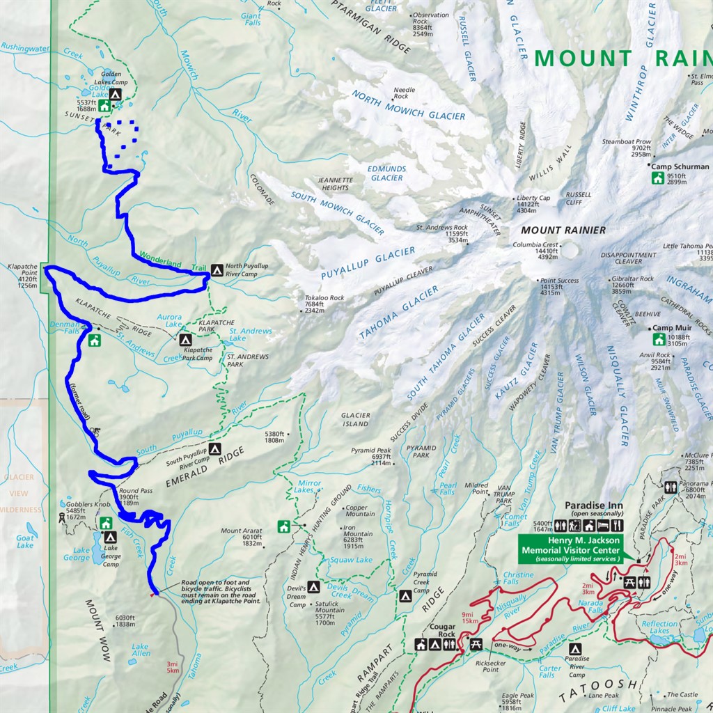
Sunset Park Lookout Site Difficulty: strenuous and off-trail 35 miles Elevation gain: 5750' Max elevation: 5710' Camps: North Puyallup River (if you come from the south) or South Mowich River + Golden Lakes (from the north) First hiked by me: 2023 |
This is an off-trail route. Only come here if your navigation is up to the task of finding your way where there are no trails to follow, and practice Leave No Trace to avoid damaging fragile terrain.
I can't decide which of two possible stories to frame this article with, so how about I just use them both?
STORY 1 - HISTORICAL
In the early 20th century the Forest Service decided that building fire lookouts in high places would be a great way to get early warning of destructive forest fires, and there was nowhere higher than Rainier to put these. They started in 1916 with a lookout at Anvil Rock, 9500' elevation on the Muir snowfield. This was followed in 1930 by a second lookout high on the ridge that leads to Colonnade, 6900' on the northwest flank of the mountain.
Over time the Forest Service came to realize they had made a fundamental error. One can indeed see far from these high places on a clear day, but perfectly clear days are uncommon in the Pacific Northwest climate! More often there would be a layer of cloud sitting BELOW the lookouts and blocking the view.
In 1948 the Colonnade lookout was relocated lower down the same ridge, to a spot in Sunset Park at 5580', just above Golden Lakes. This was abandoned in the 1960s after lookout duties were taken over by airplanes, then removed in 1973, leaving a bare spot where the structure once stood.
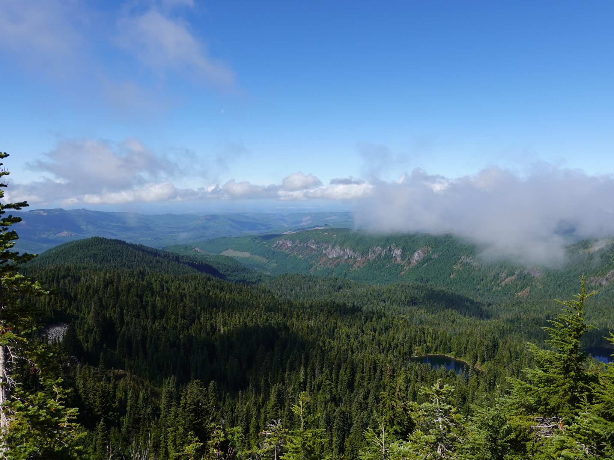
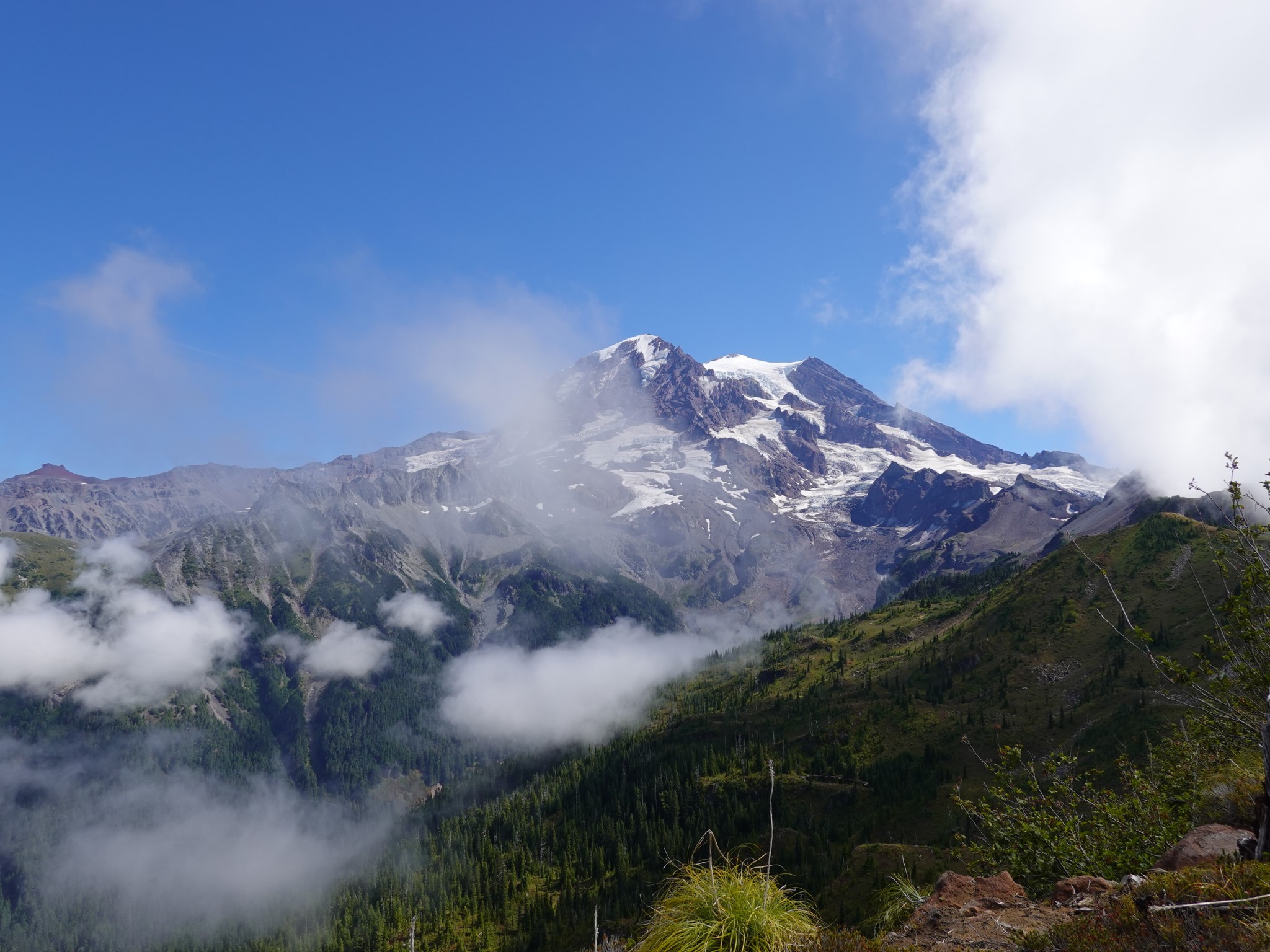
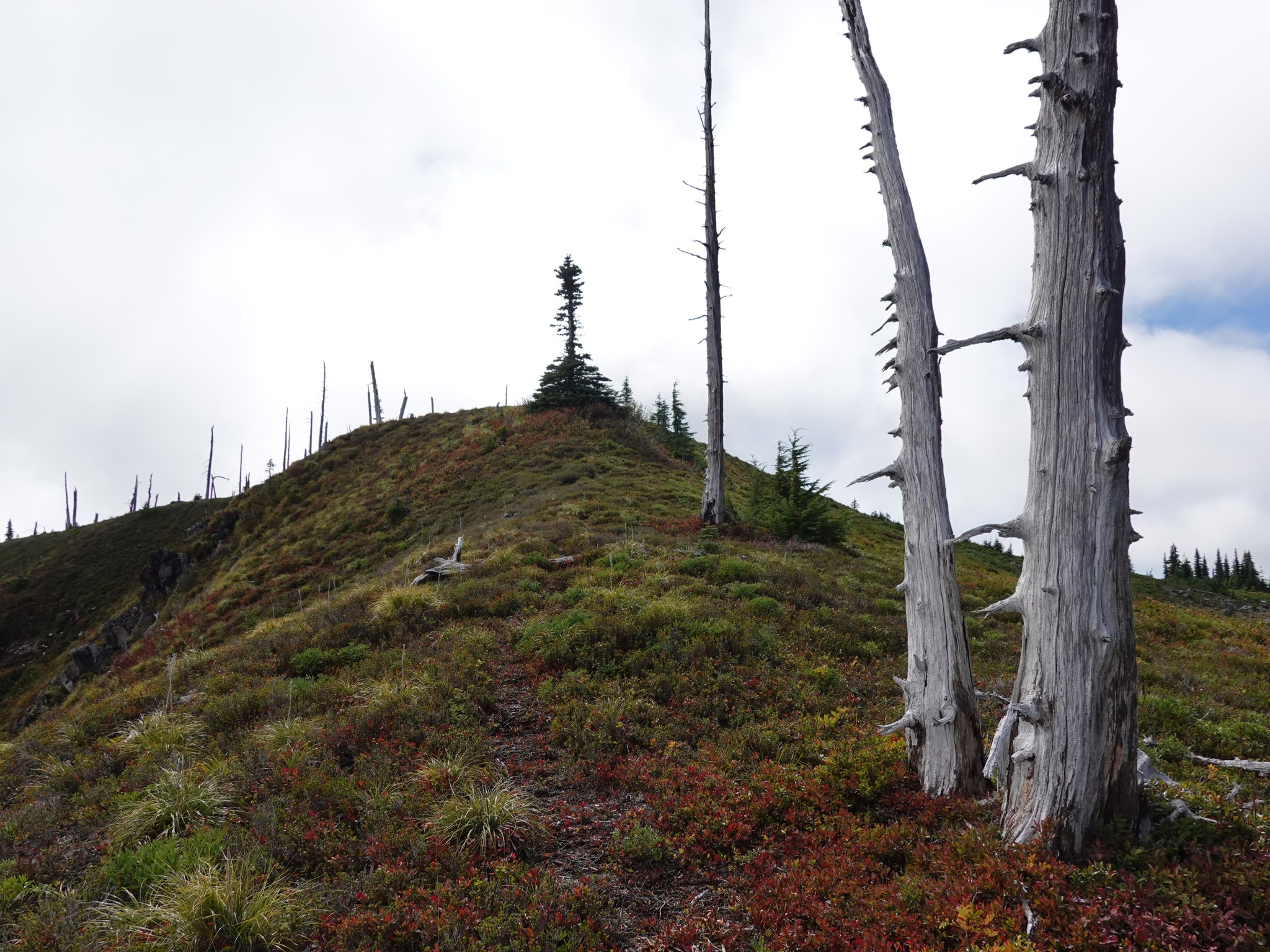
The (lower) former lookout site offers stunning views in all directions, in an area of gently sloped high meadows ornamented by the bleached white skeletons of trees killed by an old fire. Once up here it only makes sense to visit both Sunset Lookout and Sunset Benchmark, as their views are different and the walk between them is easy. It is also possible to continue further up the ridge toward Colonnade and the original lookout location, but I'd had enough for this day.
There are remnants of old trails everywhere in this area, and (at least) two reasonable ways to get from the Wonderland to the lookout site. I took one up and the other down: see the dotted portion of the map above for a rough idea.
STORY 2 - PERSONAL
The off-trail part of this hike is a trivial 2 miles with 500' elevation gain. The challenge is getting there, as it starts by turning off from the most remote section of the Wonderland Trail. For me, this kind of distance requires a staging camp. Options are to hike the Paul Peak Trail and then Wonderland from the north, camping at Golden Lakes, or up the Westside Road and then Wonderland from the south, camping at North Puyallup. The former is less distance, but I chose the latter (which is the distance and map shown above) because it allows riding a bike up the closed-to-cars Westside Road portion.
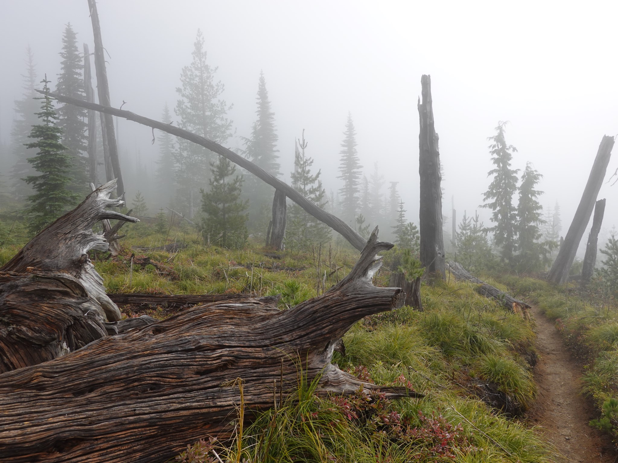
I had reservations for two nights at North Puyallup Camp. The forecast was good. I biked up the road, hiked 3 miles down the North Puyallup Trail, and set up my tent for the night. I was inside a cloud the whole way. Everything got damp. I was cold overnight.
No problem, thinks I, surely this will burn off tomorrow. But I awoke to continuing fog. Other Wonderlanders sharing the camp were debating whether to bail after several days of bad weather had left all their gear soaked. Perhaps I should bail too? The cloud looked like it was here to stay, and I saw no point in a strenuous hike up to see nothing at all.
I decided to ask my InReach satellite communicator for an updated weather forecast. It doesn't always connect well when the sky is not clear, so I waited half an hour for it to tell me the day would remain cloudy and cold.
You know how when you can't make a decision, sometimes you'll ask someone else to choose for you, but when they tell you what they've picked you realize you actually had an opinion all along?
The moment the InReach completed its download and told me there would be no views this day, I thought nope. Forecasts can be wrong. Weather may change with time or altitude. And if not, I enjoy hiking through misty trees, and my tent is set up with warm dry sleeping things waiting for me afterward, so what do I have to lose.
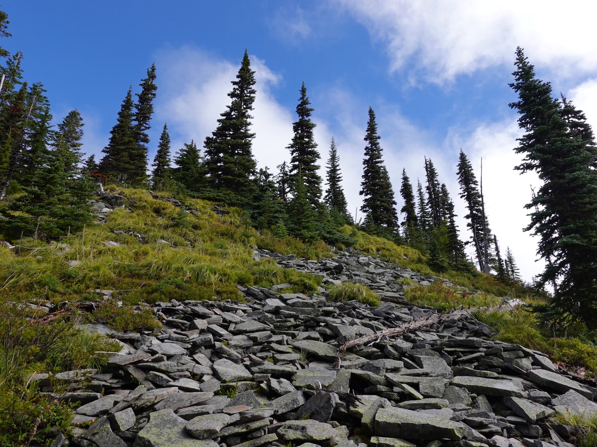
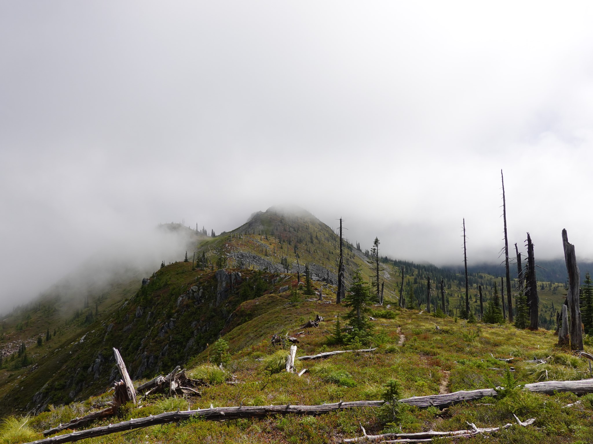
Up I went, along the Wonderland. The forest was misty and beautiful. Entering Sunset Park, I was inside the cloud. Starting the off-trail portion of the hike, I turned off the Wonderland, found a few old paths to follow, crossed a couple of small meadows with only silhouettes of trees looming through the mist beyond them, scrambled up the last short steep section to the former lookout site, and...
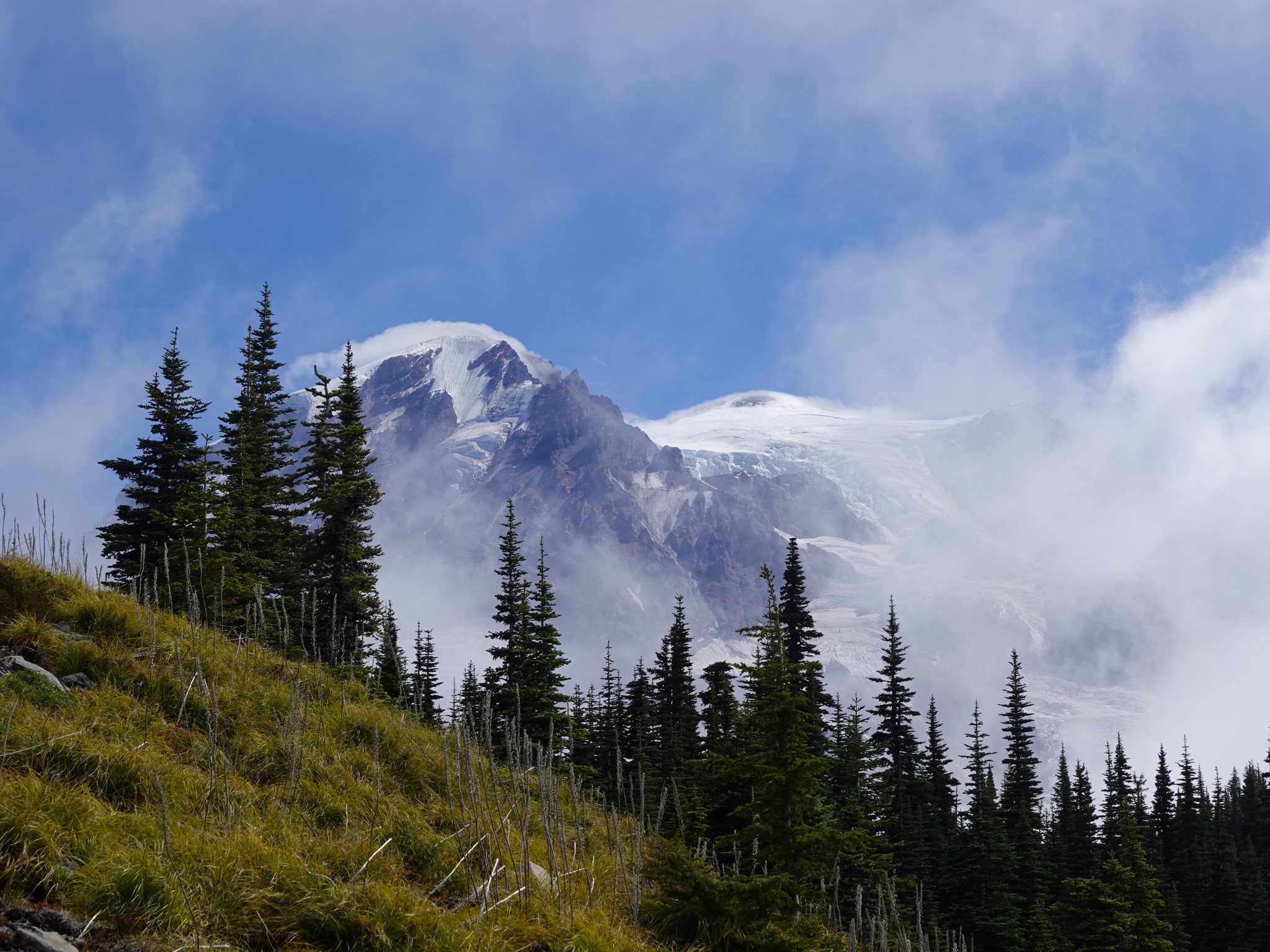
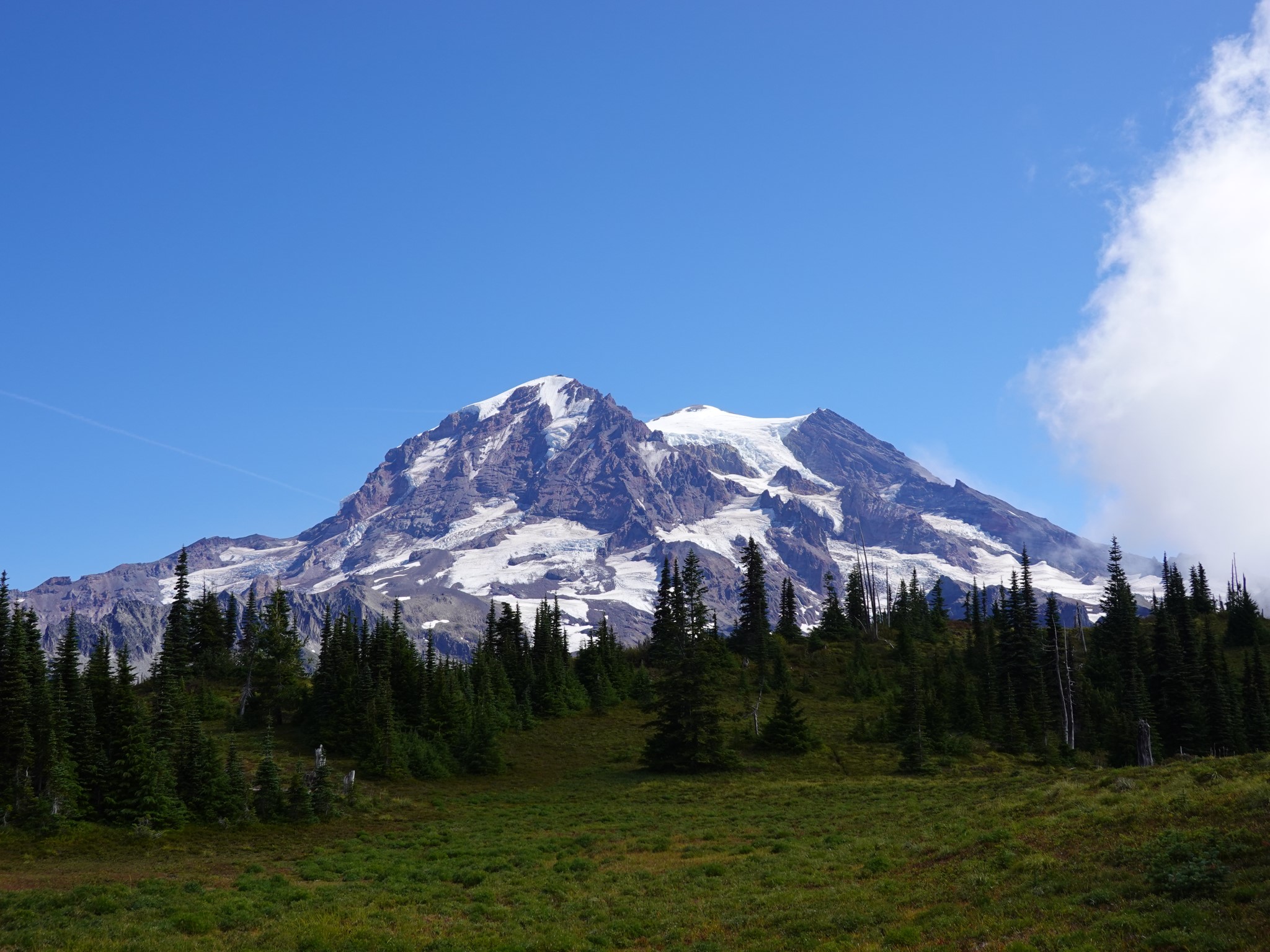
WHAT IS THIS? I CAN SEE GOLDEN LAKES BELOW ME, AND THE WHOLE WORLD BEYOND. TURNING AROUND, OMG!!!
The mountain came out. And stayed out for a good half hour while I explored between the lookout site and Sunset Benchmark. Then she folded a layer of cloud back over herself, like she was saying "ok, you've had enough fun, time to head back to camp now".
I felt like I'd been rewarded for having faith. It's well said that this mountain makes her own weather.